")
")


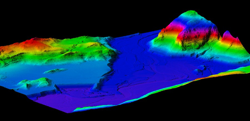
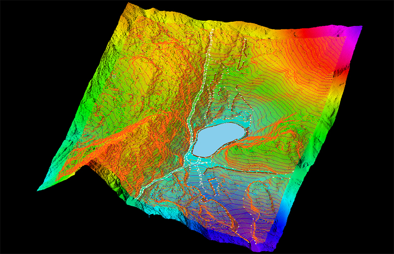
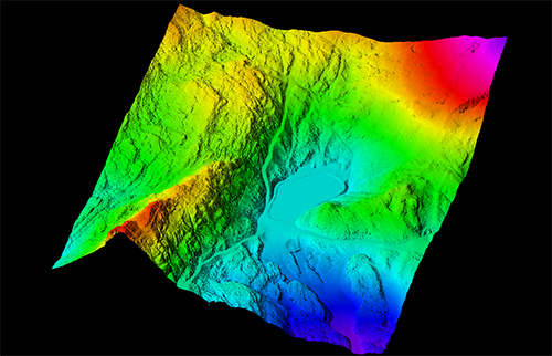
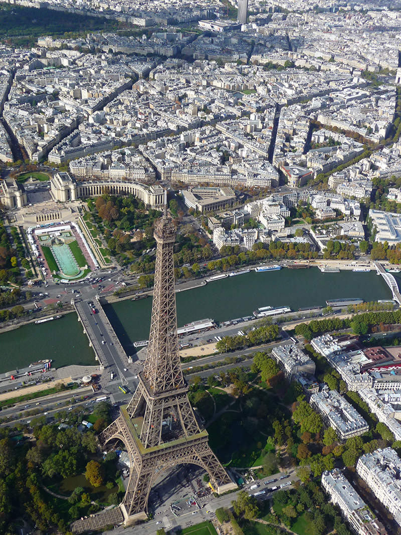
In airborne mode, the recent application of the Lidar technology (Light Detection and Ranging) to topography and mapping provide high density digital terrain models (MNT) or surface (MNS) with great efficiency.
Lidar remote sensing is the only technique capable of simultaneously detecting the surface of the ground and vegetation. It then provides a DTM of the soil and a DSM of the canopy. A density of several points per m² is accessible.
This non-intrusive technique is particularly suitable for topographical surveys of heavily forested areas, uneven or difficult to access.
This technology coupled with decades of production and innovation in photogrammetry has allowed us to acquire skills from acquisition to topographic drawings or high density 3D digital models.
A high resolution stereoscopic photographic coverage may be associated with the lidar survey to provide orthophoto.
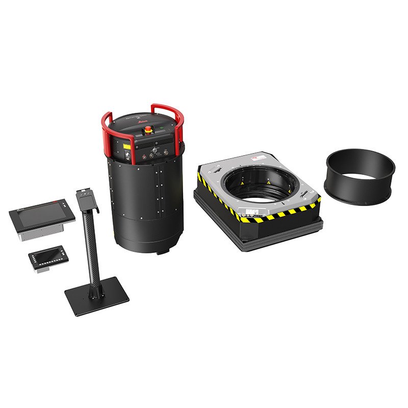
Our LiDAR sensors
APEI has a two Leica sensor which provide LiDAR data: CityMapper 2 with Hyperion 2+ and TerrainMapper 2 with Hyperion 2. These sensorscan be installed on all airplanes. This gives us high availability and rapid implementation, in France or abroad.
To read more about our CityMapper 2
To read more about our TerrainMapper 2
Deliverables : DTM / DSM / Contours / profiles / intensity images …
Applications
This technology is applicable to different types of needs:
- Corridors linear projects
- Forest management
- Mining
- Mountainous topography, cliffs, glaciers …
- Natural hazards
- Urban digital elevation model
- Hydraulic Projects and Studies (banks...)
Our experience in aerial acquisition, in aerospace and imaging allow us to offer related services to help you optimize your project:
- Training of your personnel (operators)
- Pilots training (DNC)
- Consulting and optimizing organization (eg. Setting up ISO9001)
- Study and flight plan optimization
- Set mission acquisition in France or abroad
- Advice in the drafting technical specification
Contact us for a personalized solution to your needs.
Reference
CNTC - Tunisia
Practical training of Tunisian camera operators (2 OTC technicians and 2 CNCT techicians ) took place in September 2011 in our facility.
 Learn more…
To meet your specifications, we can use at least 3 digital cameras. We operate our digital cameras since 2004 and we are a service provider recognized for our quality and rigorousness.
We use the Leica software suite for preparing flight plans. This is an essential phase for the effective respect of your requirements. Indeed, our MissionPro software integrates a highly accurate digital terrain model which adapts flight lines regardless of the state of the relief: The sidelap and along track overlaps and the GSD are respected everywhere in the area.
All cameras are installed on gyrostabilized platforms which continuously compensate the aircraft movements to maintain the verticality of the camera.
For the trajectory, our cameras are equipped with inertial high resolution coupled with dual frequency GNSS receiver. The combination of these data allows us to position each image in space (X, Y, Z, Phi, Omega, Kappa) with a relative accuracy of 10cm.
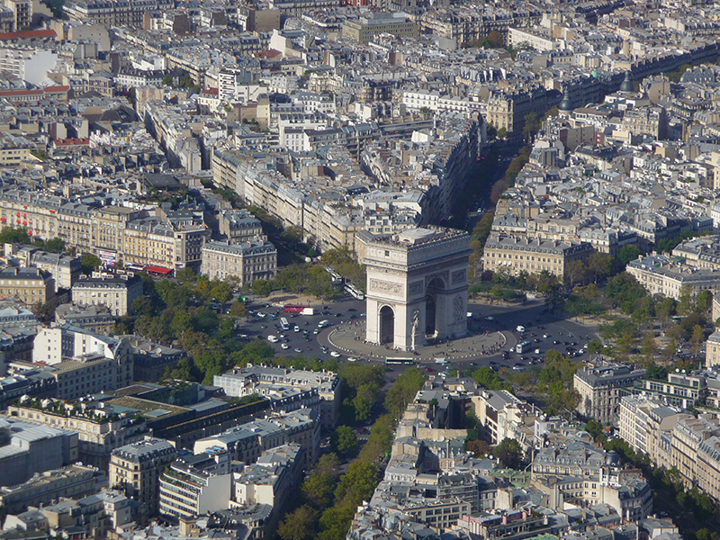
The vertical aerial images are mainly used for orthophoto production and photogrammetric maps, but are also commonly used for communication or to create virtual 3D models (see Applications).
Specifications DMC
- Ground sample distance from 60cm to 3cm/pixel
- RGB images, Panchromatic, RGBN or IRC in 8, 12 or 14 bits
- Trajectory GNSS/IMU in the desired coordinate system
- Building leaning following sidelap and overlap.
Resources and production capacity
- 1 digital camera Z/I Imaging DMCIIi
- 1 digital camera Z/I Imaging DMCII/250
- 2 digital camera Z/I Imaging DMC
- 1 digital camera (middle format) Leica RCD30
- 1 digital camera (middle format) PhaseOne
- Leica Mission Pro for flight planning
- Z/I PPS and HxMap for radiometric and geometric images processing
- Leica IPAS TC/Co+ and Inertial Explorer for trajectory processing
Download
 Local communities are no longer limited to the vision in 2D and require more and more 3D modeling of urban areas. This modeling can be done in two ways:
- By using a vertical camera building leaning of the edges of images. In this case we need to set a strong lateral and longitudinal overlaps so that to shot the 4 facades of each building.
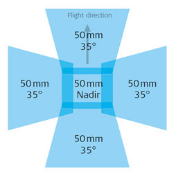
- The second method is to use an oblique penta camera that allows the simultaneous acquisition of vertical pictures (nadir) and oblique (front / rear and left side / right).
These photogrammetric cameras allows the building facades texturing with a high precision draping.
You have your own a sensor, lidar or any other system but you do not have an airplane equipped with a hatch …
APEI can provide you with one of the 8 aircrafts of our fleet as well as an experienced professionnal pilot.
Do not hesitate to contact us and we'll offer the appropriate aircraft for your particular project according to your budget and technical constraints ( flying altitude, acquisition speed, regulatory requirements, system dimensions, power consumption of your equipment …)
Example of mission
- Fire Detection
- Aerial television relay
- Vertical shooting with the sensor of a third party (UCX Utracam, Leica ADS80...)
- Oblique acquisition (Midas, Ultracam Osprey, Leica RCD30 ...)
- Other types of aerial acquisitions (multispectral, batyhmetric)
- Survey…